By Global News Desk
Published: September 10, 2026
Main Facts: The Legacy of August 10
It has been exactly one month since a powerful 7.4-magnitude earthquake struck western Colombia, shattering communities, reshaping landscapes, and leaving an indelible mark on the nation’s collective consciousness. Centered in San José del Palmar, Chocó, the catastrophic tremor—which struck on August 10, 2026—remains one of the most significant seismic events in the region’s recent history.
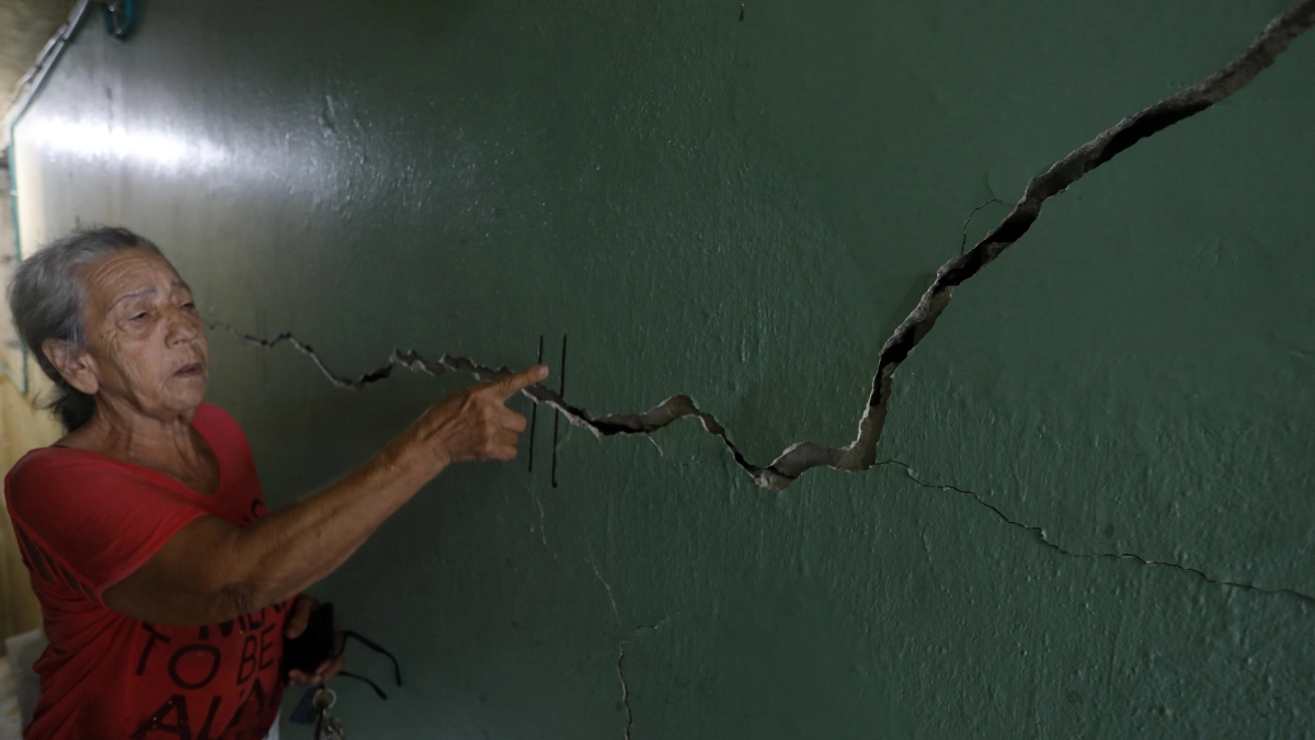
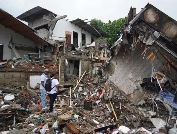
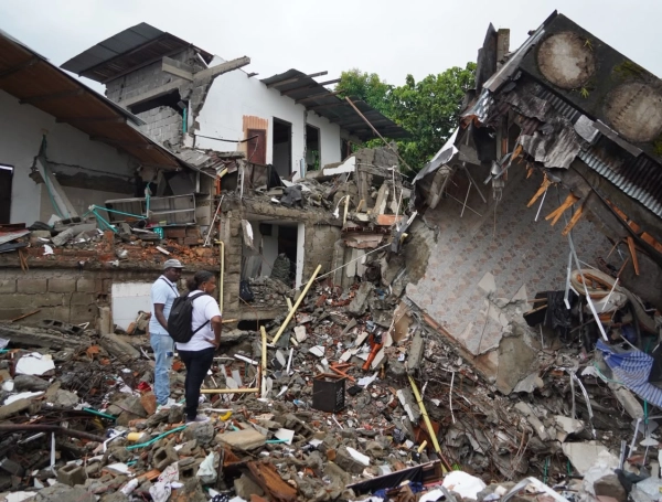
While emergency responders and humanitarian agencies continue the arduous task of delivering aid to the hardest-hit zones, scientific institutions are painting a clearer picture of the disaster’s true scale. According to the latest balance, the partial death toll stands at more than 300 fatalities, with upwards of 4,000 individuals sustaining injuries. Entire neighborhoods were reduced to rubble, vital infrastructure was compromised, and thousands of families were left homeless, grappling with an uncertain future.
Beyond the immediate human toll, the earthquake triggered a relentless sequence of aftershocks and geological shifts that continue to challenge scientists and test the resilience of local infrastructure. As the country pauses to reflect on the disaster one month later, government bodies, scientific authorities, and international organizations are assessing both the physical damage and the long-term implications for disaster risk management in Colombia.

Chronology of the Crisis: From the First Tremor to One Month On
August 10, 2026: The Day the Earth Moved
At a depth and magnitude capable of causing widespread devastation, the 7.4-magnitude earthquake struck with its epicenter in San José del Palmar, Chocó. Within seconds, the shockwaves reverberated across western Colombia, heavily impacting departments including Chocó, Valle del Cauca, Risaralda, Caldas, and Quindío. Urban centers like Pereira, Manizales, Cali, and Quibdó experienced intense shaking, resulting in structural collapses, severed power lines, and widespread panic.
Mid-August: Immediate Search, Rescue, and Assessment
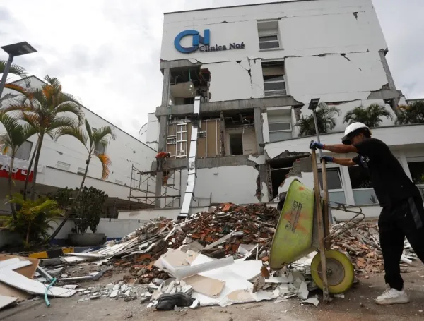
In the days immediately following the catastrophe, rescue teams deployed to affected areas to search for survivors trapped beneath collapsed buildings, such as the iconic Clínica Noé in Pereira and parts of downtown Quibdó. Simultaneously, the Colombian Geological Survey (SGC) mobilized field teams to begin initial damage assessments, while humanitarian corridors opened to deliver emergency supplies, clean water, and medical aid to isolated communities.
Late August to Early September: The Scientific Deep Dive
As rescue efforts gradually transitioned into recovery and demolition phases—such as the systematic leveling of structurally compromised buildings in Cali—scientific monitoring intensified. The SGC deployed specialized equipment to measure land deformation, inspect seismic stations, and map terrain failures.
September 10, 2026: The One-Month Milestone
Marking one month since the disaster, authorities report that over 1,300 tons of humanitarian aid have successfully reached 45 vulnerable communities across the nation. However, the milestone is also marked by ongoing challenges, including thousands of displaced citizens still waiting for permanent housing subsidies and comprehensive psychological support.
Supporting Data: The Geological Aftermath and Technical Findings
The Colombian Geological Survey (SGC) has maintained continuous, round-the-clock surveillance of the affected regions. Freddy Tovar, coordinator of the National Seismological Network of Colombia, provided a detailed technical update outlining the unprecedented level of post-earthquake activity.
Aftershocks and Seismic Swarms
As of Thursday, September 10, scientists have identified more than 300 aftershocks directly associated with the August 10 mainshock. Notably, all of these verified aftershocks have registered at depths greater than 70 kilometers.
In addition to these deep aftershocks, a distinct seismic swarm has been documented in Chocó. This swarm comprises more than 1,200 individual events, all occurring at shallower depths of less than 70 kilometers, keeping the region in a state of heightened geological alertness.
Ground Deformation and Crustal Studies
To understand how the earth’s crust shifted during the disaster, SGC researchers utilized advanced technology. The network deployed eight episodic GNSS (Global Navigation Satellite System) stations, recording continuous data for periods ranging between 96 and 120 hours. These high-precision measurements allow scientists to calculate millimeter-level crustal displacements, pinpointing the exact zones where tectonic stress remains critically high.
Landslides and Mass Movements
The violent shaking did not merely disrupt urban infrastructure; it dramatically altered the natural topography of western Colombia. Through rigorous satellite imagery analysis, the SGC identified 240 mass movements (landslides) triggered or reactivated by the seismic event. These geological hazards were primarily concentrated across the departments of:
- Chocó
- Valle del Cauca
- Risaralda
- Caldas
- Tolima
Furthermore, field teams successfully performed critical maintenance on five permanent stations of the National Seismological Network located strategically across Chocó and Valle del Cauca to ensure uninterrupted data flow for future early-warning systems.
Official Responses and Field Evaluations
The response to the disaster has required a massive, coordinated effort involving national agencies, local governments, and specialized scientific teams.
Comprehensive Field Inspections
Over the past four weeks, SGC experts have traversed more than 20 municipalities and cities, visiting regions such as Quindío, Versalles, Viterbo, Trujillo, Manizales, Cali, and Pereira. Rather than relying solely on remote sensors, these teams conducted qualitative and quantitative evaluations based on human perception reports, structural integrity assessments, and direct field observations.

Vulnerability in Historic and Traditional Architecture
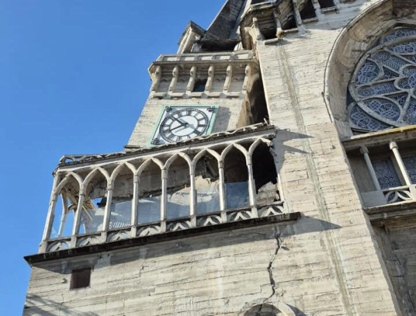
The official findings indicate that the most severe structural failures were not isolated to modern engineering, but rather concentrated in vulnerable, older, or poorly maintained constructions.
- Traditional Materials: Widespread collapses and severe damage were documented in buildings constructed using traditional techniques such as bahareque (wattle and daub), tapia pisada (rammed earth), and adobe.
- Structural Flaws: Many of these historic or vernacular structures featured heavy, unreinforced roofing materials and deteriorated load-bearing frames.
- Topographical Vulnerability: Buildings situated on steep slopes experienced compounding structural stress, exacerbating the collapse rate during the primary tremor and subsequent high-magnitude aftershocks.
Implications: The Human Cost, Reconstruction, and Future Risk Management
The Social Tragedy: A Crisis of Housing
While the scientific data offers vital insights for seismologists, the human dimension of the disaster remains profound. One month after the earthquake, thousands of individuals who lost their homes face what local media and social advocates are calling "the second tragedy." Many families are still awaiting government housing subsidies and temporary shelter solutions, highlighting bureaucratic bottlenecks in disaster relief distribution.

The psychological toll on survivors—particularly children, the elderly, and hospital patients displaced by structural failures like that of Pereira’s Clínica Noé—requires sustained, long-term state intervention.
Scientific Lessons and Disaster Risk Reduction
The extensive data collected by the SGC over the past month is not merely academic; it is foundational for Colombia’s future. By mapping crustal deformation, analyzing landslide distributions, and identifying the structural vulnerabilities of traditional architecture, the government aims to overhaul national building codes and urban planning strategies.

The integration of satellite telemetry, episodic GNSS monitoring, and an upgraded National Seismological Network represents a vital step forward. As Colombia navigates the painful road to recovery, the lessons learned from the San José del Palmar earthquake will serve as a critical blueprint for mitigating future seismic risks, protecting human lives, and fostering resilient communities across the Andean and Pacific regions.