By Edwin Caicedo | Environmental and Health Journalist Updated: September 26, 2026
Main Facts: The Scope of Colombia’s Burned Landscapes
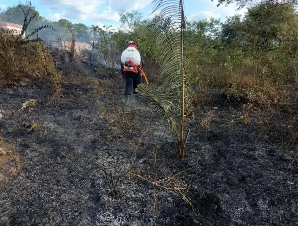
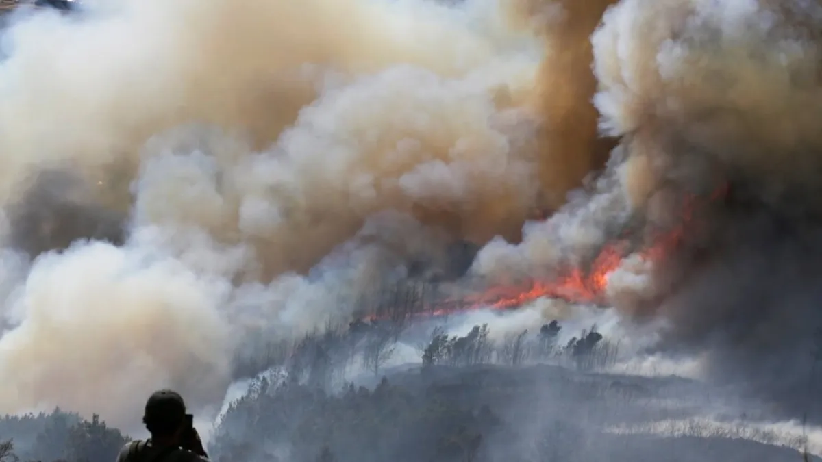
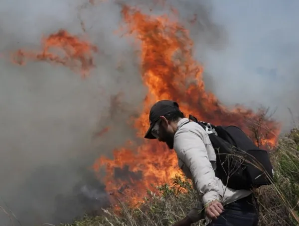
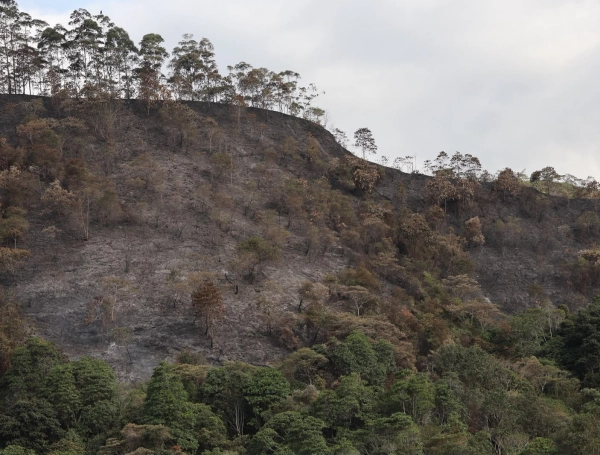
Colombia has endured the devastating loss of approximately 13.9 million hectares to fires over the past 26 years, an expansive territory that accounts for 12.1% of the country’s entire continental landmass. To put this staggering figure into perspective, the scorched area is roughly equivalent to 314 times the urban footprint of Bogotá, or nearly 60 times the size of financial hubs like Luxembourg.
These revelations form the core of a groundbreaking historical series released by MapBiomas Fuego, a collaborative scientific initiative designed to decode the patterns, frequencies, and recurrences of forest fires and agricultural burnings across the nation. By processing decades of satellite imagery spanning from 2000 to 2025, researchers have mapped out how fire behaves across different regions, departments, ecosystems, and land-cover types.
The data indicates that Colombia loses an annual average of 2.31 million hectares to fires—a yearly loss matching 12.5 times the area of Quindío department. However, this destruction is far from uniform. The geographical epicenter of the crisis is unequivocally the Orinoquía region, which concentrates 68.7% of all burned areas in the country, followed by the Amazon basin at 13.2%. At the departmental level, Vichada emerges as the most severely impacted territory, with an astounding 4.8 million hectares burned over the 26-year study period—effectively searing half of its entire territory.
Chronology of the Initiative: Building a Historical Record of Fire
The release of MapBiomas Fuego represents the latest milestone in a rigorous, multi-year scientific effort to monitor Colombia’s environmental health through remote sensing and data science. The timeline of this broader network outlines a steady progression toward total ecological transparency:
2018: The MapBiomas network officially launches its footprint in Colombia, initiating annual land-cover and land-use mapping specifically focused on the fragile Amazonian region.
2023: The initiative publishes its inaugural national collection of land-cover maps, tracing human and natural transformations across the country from 1985 through 2022.
2024: Expanding its analytical toolkit, the network rolls out MapBiomas Agua, introducing monthly tracking of continental surface waters to measure droughts, river shrinking, and wetland dynamics.
2026 (Early Year): The network debuts MapBiomas Alerta, a specialized platform designed to cross-validate multiple deforestation alert streams across Colombia in near-real-time.
September 2026: MapBiomas launches its comprehensive Fuego (Fire) collection. For the first time, researchers, policymakers, and communities gain access to a 26-year retrospective analysis detailing precisely where, when, and how frequently Colombian landscapes have gone up in smoke.
Supporting Data: Temporal and Geographical Breakdowns
The depth of the MapBiomas Fuego dataset moves past generalized estimates, offering granular insights into the seasonal and spatial rhythms of fire in Colombia.
1. Temporal Concentration: The Dry Season Hazard
Fire in Colombia is fundamentally seasonal. The data reveals that 83.3% of all burned areas between 2000 and 2025 occurred strictly between December and March. This four-month window aligns with the primary dry seasons, during which high temperatures, low humidity, and agricultural clearing practices converge to prime landscapes for runaway blazes.
2. Recurrence and Persistence
Beyond total acreage, the platform exposes chronic burn patterns. In the Orinoquía alone, 1.6 million hectares have burned at least once, while a staggering 509,500 hectares have endured ten or more distinct fire events over the 26-year timeline. This high frequency signals that certain ecosystems are caught in a destructive feedback loop, undermining soil health and preventing native forest regeneration.
3. Protected Areas and Indigenous Territories Under Fire
The 2025 data sounds a severe alarm regarding legally protected zones. According to the platform, burned areas inside protected zones and Indigenous territories spiked by 14.1% compared to the historical average. This upward trend was driven primarily by intensifying fires in the Orinoquía, even as the Pacific, Andean, and Caribbean regions experienced slight decreases in protected-area burn rates.
Official Responses and Expert Perspectives: Moving from Reaction to Anticipation
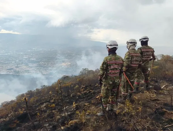
The unveiling of these historical datasets arrives at a critical juncture. The Institute of Hydrology, Meteorology and Environmental Studies (Ideam) has issued warnings indicating a probability exceeding 90% that a severe El Niño phenomenon will intensify during the final quarter of 2026. Coupled with recent high-profile emergencies—such as the massive fires in Villa de Leyva (Boyacá) and across ecosystems like Iguaque and the high Andean paramos—Colombia’s disaster management faces unprecedented pressure.
Experts argue that tools like MapBiomas Fuego are essential to break the cycle of reactive emergency response.
"MapBiomas Fuego allows us to transition from merely reacting to fire to anticipating it," noted Adriana Rojas Suárez, coordinator of MapBiomas Colombia. "By providing historical analysis broken down by region and month, risk managers can plan ahead. Furthermore, it serves as an invaluable resource for researchers and local communities that traditionally use fire in their territories."
Echoing this sentiment, Dr. Stijn Hantson, associate professor at Universidad Rosario and lead researcher, emphasized the historical knowledge gap that has hampered public policy:
"Understanding fire regimes and the ecological role of fire is vital for territorial management and public policy in Colombia, yet we have historically operated with limited data," Hantson explained. "MapBiomas Fuego supplies the long-term historical context required to understand how this phenomenon operates within complex Colombian landscapes."
Implications for Public Policy and Environmental Management
The implications of the MapBiomas Fuego database extend far beyond academic research. By making its entire archive of annual maps, frequency grids, and land-cover impact metrics freely available to the public, the platform reshapes several fronts of national development:
Territorial Planning and Risk Management
Local governments, departmental authorities, and disaster response units (such as the UNGRD) can now consult granular municipal-level data to identify chronic high-risk zones. Instead of deploying resources blindly during seasonal peaks, regional planners can implement preventative measures—such as controlled burns, firebreaks, and community education—months before the dry season peaks.
Redefining Fire: Threat vs. Ecological Dynamic
For decades, institutional frameworks treated all fire as an ecological evil to be extinguished immediately. However, scientists point out that certain ecosystems in the Orinoquía and savanna biomes evolved with natural fire cycles. The new historical data allows conservationists to distinguish between harmful, human-induced deforestation fires and historical fire regimes, paving the way for nuanced, ecosystem-specific management policies.
Accountability and Climate Commitments
As Colombia faces strict international deadlines to reduce greenhouse gas emissions and curb deforestation under global climate agreements, the MapBiomas ecosystem provides an independent, transparent auditing mechanism. Tracking burn trends in carbon-rich biomes like the Amazon and Orinoquía ensures that state agencies and international watchdogs can accurately measure the success or failure of environmental policies over time.
A Collaborative Regional Effort
MapBiomas Colombia operates as a multidisciplinary coalition bringing together top-tier academic institutions, research centers, and civil society organizations. The current steering members include Fundación Gaia Amazonas (national coordinator), the National University of Colombia, Universidad del Rosario, Pontificia Universidad Javeriana, Fundación Avina, and the International Center for Tropical Agriculture (CIAT).
Globally, the MapBiomas initiative originated in Brazil in 2015 and has since expanded to encompass over 100 organizations across Latin America and beyond. By uniting experts in remote sensing, geographic information systems (GIS), and data science, the network continues to turn complex satellite data into open-access tools that empower citizens, scientists, and decision-makers to safeguard the natural world.
For a country that has watched nearly 14 million hectares turn to ash over a single generation, platforms like MapBiomas Fuego offer more than maps—they provide a roadmap toward resilience, transforming historical hindsight into proactive environmental stewardship.
By Angie Rodríguez / Environmental Journalism Desk Updated: September 25, 2026 Main Facts In anticipation of the severe hydrological disruptions brought on by the arrival of the El Niño phenomenon, the Ministry of Environment and…
BOGOTÁ, COLOMBIA — More than a month after a powerful 7.4-magnitude earthquake rattled Colombia’s Pacific coast, the Department of Chocó continues to experience significant geological unrest. On Sunday, September 14, the Colombian Geological Survey (Servicio…
By Editorial Staff Published: July 16, 2026 Colombia is currently grappling with a complex environmental paradox that has baffled citizens and tested the limits of disaster management agencies. While massive regions of the country remain…