By Edwin Caicedo
Environment and Health Journalist
Special to Global Conservation Insights
Main Facts
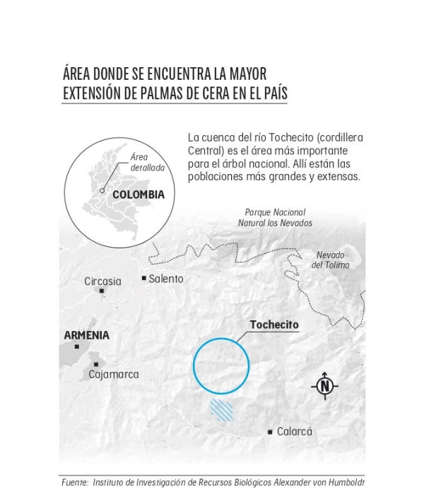
In the high-altitude folds of Colombia’s Central Cordillera, nestled between 2,000 and 3,750 meters above sea level, lies an ecological treasure: Tochecito. This critical geographical expanse recently secured a milestone in environmental protection when the Colombian government officially declared it the Palmares de Tochecito Flora Sanctuary.
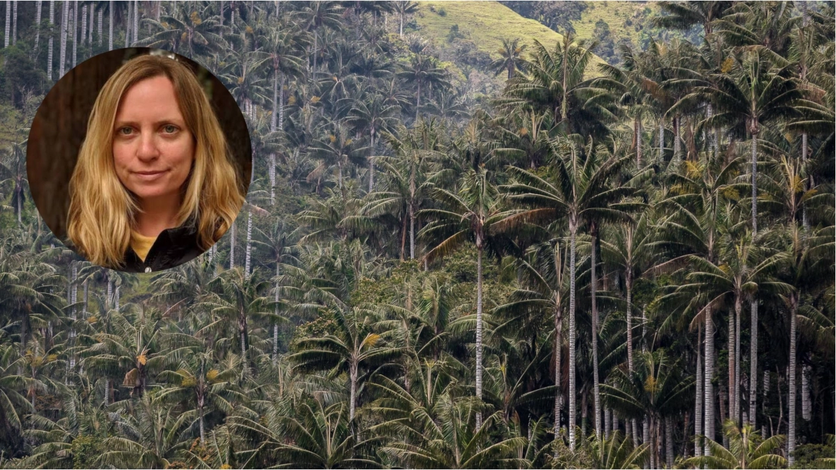
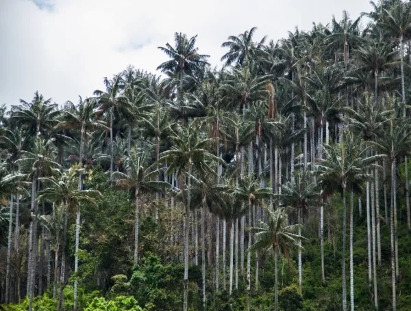
Spanning 1,964.02 hectares between the municipalities of Cajamarca and Ibagué in the Tolima department, the newly minted protected area safeguards the most vital concentration of the wax palm (Ceroxylon quindiuense) on Earth. Tochecito harbors roughly 300,000 adult individuals of the national tree—the tallest palm species in the world—accounting for more than 70 percent of the nation’s registered population.
Beyond its botanical significance, Tochecito serves as an irreplaceable sanctuary for threatened fauna. Endangered and vulnerable wildlife, including the yellow-eared parrot (Ognorhynchus icterotis), the ruddy duck (paramo parakeet), the Andean bear (Tremarctos ornatus), and the mountain tapir (Tapirus pinchaque), alongside hundreds of other bird and mammal species, depend directly on this ecosystem for survival.

Crucially, the establishment of this protected area was not merely the result of traditional field biology. It represents a landmark convergence of grassroots scientific research, institutional governance, and cutting-edge geospatial technology. Through financial backing and unprecedented computational capacity provided by Google—specifically leveraging the power of Google Earth Engine—researchers from the Alexander von Humboldt Biological Resources Research Institute were able to model species distribution, map high-density wax palm clusters, and present irrefutable scientific evidence to government authorities.
Chronology: The Road to Protection
The journey toward establishing the Palmares de Tochecito Flora Sanctuary spans decades of conservation struggles, scientific monitoring, and technological evolution.
- Early Conservation Efforts (Pre-2023): For years, local environmentalists, regional NGOs, and the Alexander von Humboldt Institute recognized Tochecito as a biological hotspot. However, building a legally binding case for a protected area requires rigorous, large-scale data regarding species distribution, population density, and ecological vulnerability—resources that are often difficult to compile across rugged Andean terrain.
- The Technological Turn (2023): As part of a broader philanthropic and environmental initiative, tech giant Google stepped in to support conservation organizations worldwide. By supplying financial grants and high-performance computing power via Google Earth Engine, Google enabled the Humboldt Institute to scale up its mapping capabilities.
- Data Delivery to Authorities (2023–2024): Researchers integrated satellite imagery, remote sensing data, and ecological variables into Google’s cloud infrastructure. The resulting high-confidence species distribution maps for the wax palm were handed over to the Ministry of Environment and regulatory authorities to substantiate the ecological urgency of the region.
- The Presidential Decree (Late 2026): Building upon the scientific foundation and years of institutional groundwork, the outgoing administration of Gustavo Petro officially signed the decree establishing the Santuario de Flora Palmares de Tochecito, integrating it into Colombia’s National Natural Parks System.
Supporting Data & Ecological Importance
To understand the gravity of the Tochecito declaration, one must examine the staggering metrics of biodiversity and geography that define the basin.
Geographical and Botanical Scale
- The Tochecito Basin: Encompasses approximately 8,885 hectares on the eastern slopes of the Central Cordillera.
- The Protected Sanctuary: Covers 1,964.02 hectares, capturing the absolute core of the wax palm population.
- Species Richness: The Alexander von Humboldt Institute has documented roughly 163 plant species, over 300 bird species, and 34 mammal species within the broader ecosystem.
Interdependent Ecosystems
The wax palm is not a passive element of the landscape; it is a foundational species. The yellow-eared parrot and the paramo parakeet rely entirely on the mature trunks of wax palms for nesting cavities and their fruit for sustenance. If the palms vanish, these endemic avian species face immediate extinction.
Furthermore, Tochecito plays a vital role in regional hydrological regulation. The area forms part of the upper Coello River basin, giving rise to essential tributaries such as the San Rafael, Dantas, and Pajaritos creeks. These waterways feed the Toche and Coello rivers, supplying freshwater to local communities downstream and anchoring the ecological health of the entire region.
Official Responses and Perspectives
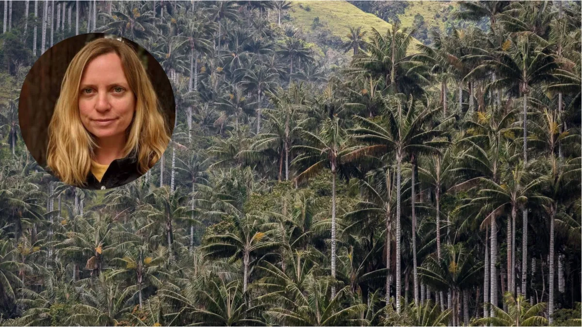
The synergy between multinational technology corporations and local conservation science offers a fascinating template for future environmental protections. In an exclusive interview, Tanya Birch, Geo Sustainability Nature Lead and Senior Program Manager at Google, detailed how the company’s technological contributions functioned behind the scenes.
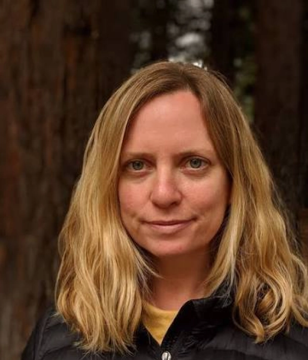
"In 2023, we provided these species distribution maps for the wax palm to the authorities and the Ministry of Environment," Birch told EL TIEMPO. "We are genuinely proud of the role that technology has played in providing part of that evidence—data to support the creation of the protected area."
Birch was careful to contextualize Google’s role, emphasizing that software and computing power do not replace human governance, community action, or rigorous fieldwork.
"There are many things that have to happen," Birch explained. "First is the base of all technological components: satellite data, remote sensing data, bioacoustics, devices that are listening, camera traps. But at the end of the day, someone has to make a decision to protect the area, enforce the law, and understand how supply chains change. We don’t pretend to have done more than help all the institutions."
According to Birch, the ultimate magic of conservation belongs to the local communities, NGOs, and public entities who understand the heartbeat of their territories. Google’s objective, she notes, is simply to ensure that "people are using Google to support the protection of an area that is important to communities," rather than imposing top-down corporate mandates.
Implications and the Future of AI in Conservation
The success of Tochecito highlights a paradigm shift in how ecological data is gathered, analyzed, and translated into public policy. As environmental crises accelerate—evidenced by historical wildfire data showing that 13.9 million hectares have burned in Colombia over the last 26 years—the speed and accuracy of conservation efforts are more critical than ever.
The Rise of Artificial Intelligence
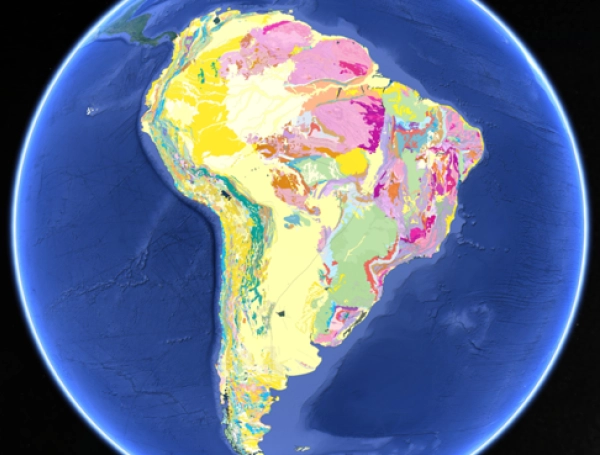
Looking ahead, Google is pushing the boundaries of conservation technology by integrating Artificial Intelligence (AI). Initiatives spearheaded by Google Research and Google DeepMind are streamlining the creation of species distribution models. Tools like Alpha Earth are being designed to map ecosystems with unprecedented resolution.
"The power lies in streamlining processes that used to be difficult and took a lot of time, and stripping away some of the tediousness," Birch stated.
By combining DNA analysis, remote sensing data, field observations, and machine learning, AI can handle heavy pre-processing tasks. This lowers the technical barrier to entry, allowing local researchers and Indigenous communities on the ground to deploy advanced mapping tools without needing specialized engineering backgrounds.
Grassroots Empowerment in Colombia
Google’s footprint in Colombia extends far beyond Tochecito. The company is actively collaborating with local institutions on AI-driven wildlife identification projects—such as analyzing automated camera-trap imagery to track elusive mammal populations. Furthermore, Google conducts intensive regional workshops to train local teams, NGOs, and public entities in utilizing Google Earth and Google Earth Engine independently.
Beyond the Declaration: The Ongoing Struggle
While the establishment of the Palmares de Tochecito Flora Sanctuary is a monumental victory, environmental experts emphasize that the hard work begins after the ink dries on the governmental decree.

The new sanctuary must now be actively managed, buffered against agricultural encroachment, and ecologically reconnected with neighboring reserves like Los Nevados National Natural Park, the Otún Quimbaya Flora and Fauna Sanctuary, and Las Hermosas National Natural Park.
As Tanya Birch aptly summarized, technological solutions are not meant to chronicle ecological collapse in high definition, but rather to empower those on the front lines:
"We don’t want to be writing the planet’s obituary with increasingly high resolution. We really want to support the people on the ground, those who are taking action to save a place."
With Tochecito now officially integrated into Colombia’s National Natural Parks System, the fusion of ancestral reverence for the wax palm and modern cloud-computing intelligence ensures that the highest palms on Earth will continue to touch the Andean sky for generations to come.