
SUBDIRECTORATE OF LIFE & ENVIRONMENT
Updated: September 13, 2026 – 08:49 A.M.
Main Facts: A Historic Lull in the Atlantic Basin
With exactly 103 days having elapsed since the official commencement of the 2026 Atlantic hurricane season, meteorologists, climate scientists, and emergency management officials are staring at an unprecedented meteorological anomaly: not a single hurricane has formed.
This startling milestone marks the longest waiting period on record for the birth of the year’s first hurricane since reliable satellite tracking began in 1966. To put this into perspective, the previous record for the late arrival of the season’s inaugural hurricane was held jointly by 2002 (Hurricane Gustav) and 2013 (Hurricane Humberto), both of which formed on September 11. Today, the first storm of equivalent strength is more than a month behind its historical schedule, with forecasting models showing no immediate atmospheric catalysts capable of triggering development in the near term.
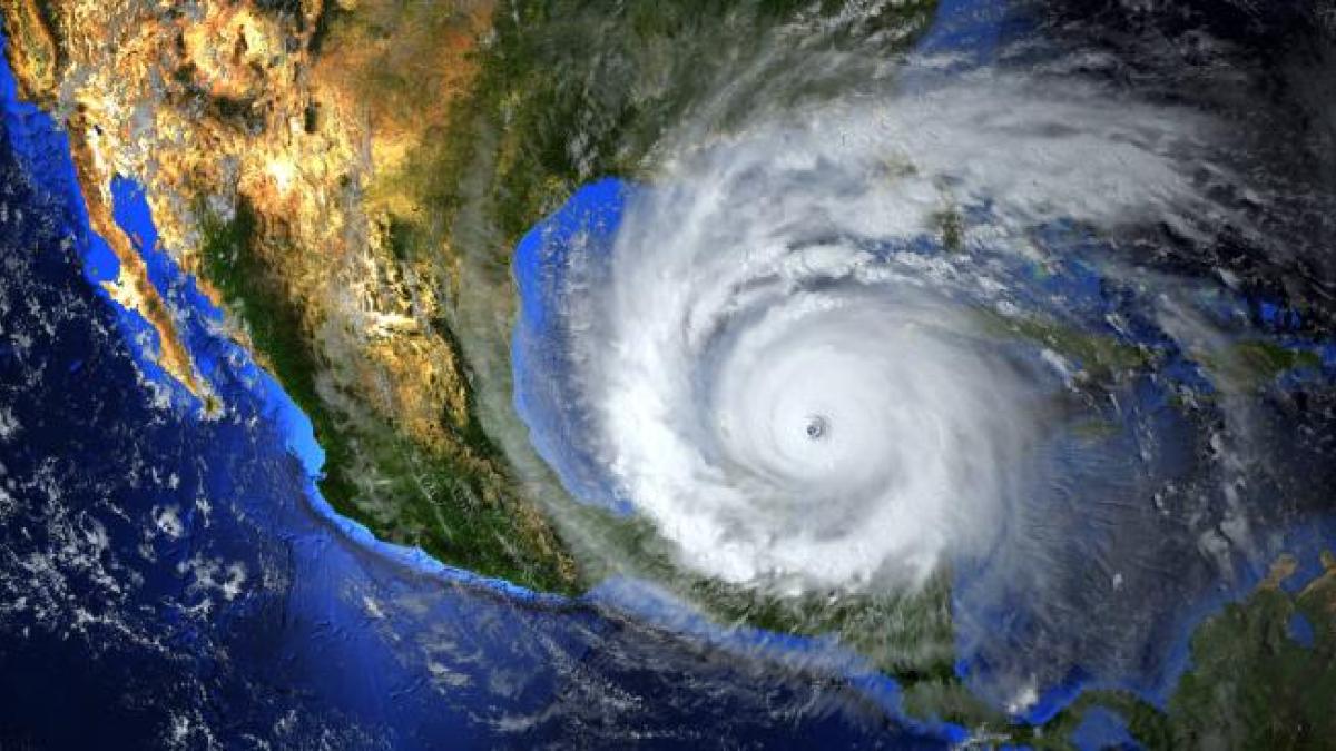
According to Phil Klotzbach, a leading hurricane researcher at Colorado State University, 2026 is rapidly tracking to become the least active season since 1950. Despite initial pre-season projections forecasting a "hyperactive" cycle boasting at least twenty-five named storms, the basin has only produced five short-lived tropical storms to date.
The system that came closest to breaking the drought was Tropical Storm Edouard on September 1. Edouard fell a mere 22 kilometers per hour short of reaching hurricane status. As it intensified, it unexpectedly made landfall near the Texas-Louisiana border, cutting short the vital warm-water fuel source provided by the Gulf of Mexico before it could transition into a full-scale hurricane.
Chronology of an Anomalous Season
To understand how the 2026 Atlantic hurricane season reached this historic stagnation, meteorologists have broken down the timeline of events from early June through the statistical peak in mid-September.

- Early June (The Onset): The season began with standard seasonal expectations, but early systems like Tropical Storm Arthur proved that lack of wind intensity did not equate to a lack of danger. Arthur’s lingering moisture dropped historic rainfall totals across the central Gulf Coast, setting up a deceptive trend where weaker systems packed unprecedented hydrological punches.
- Mid-Summer (The Great Suppression): Throughout July and August, climatologists noted an unusual lack of organized tropical waves moving off the coast of Africa. The few systems that did manage to form—such as Tropical Storm Dolly—were quickly ripped apart by hostile upper-level winds within 24 hours of their birth.
- September 1 (The Near Miss): Tropical Storm Edouard offered the best chance for the season’s first hurricane, briefly flirting with hurricane thresholds before striking the Texas-Louisiana border.
- September 11 (The Broken Record): The calendar passed the historical threshold previously shared by 2002 and 2013. For the first time since modern satellite record-keeping began, September 11 arrived and passed with zero recorded hurricanes in the Atlantic basin.
- Mid-September (The Statistical Peak): Historically, Thursday marked the climatological peak of the hurricane season. Yet, the basin remained eerily quiet, defying the traditional understanding of oceanic thermal maximums.
Supporting Data and Meteorological Mechanics: The "Kryptonita" of El Niño
September typically represents the high-water mark of the Atlantic hurricane season. During this month, sea surface temperatures—the thermal engine that powers tropical cyclones—reach their maximum geographic extent and depth. In a typical year, two to three hurricanes form during September alone. Recent history underscores this norm, recalling devastating storms like Hurricane Ian in 2022 and Hurricane Helene in 2024, both of which struck the Gulf Coast as catastrophic Category 4 systems.
In 2026, however, the ocean’s surface temperatures are more than adequate to support tropical development. The missing ingredient is not heat; rather, it is the devastating presence of vertical wind shear driven by a stubborn El Niño phase—a phenomenon experts have colloquially dubbed the "kriptonita" of tropical systems.
According to Phil Klotzbach, this wind shear reached record-shattering intensity across the Main Development Region (MDR) of the Atlantic. Stretching from the western coast of Africa to the Caribbean, the MDR is the birthplace of the basin’s most powerful storms between mid-August and early October. The sheer velocity and directional hostility of these upper-level winds have acted as an invisible shield, tearing apart nascent tropical waves before they can organize into closed circulations. Tropical Storm Dolly served as the prime casualty of this phenomenon, shredded out of existence within a day of its formation in the MDR.

Official Responses and Expert Analysis
Emergency management agencies, federal disaster relief organizations, and international meteorological offices are currently balancing cautious relief with institutional warfulness.
The National Hurricane Center (NHC) and the National Oceanic and Atmospheric Administration (NOAA) have repeatedly emphasized that a slow-starting season does not grant coastal communities a free pass from danger. Officials point to historical precedents to validate this concern. For instance, the catastrophic Category 5 Hurricane Andrew struck southern Florida in August 1992 during a season that ultimately produced only seven named storms.
Furthermore, local governments along the Gulf and Atlantic coasts have adapted their messaging away from total storm categorization and toward localized risk mitigation. Because modern warming trends have supercharged the atmosphere’s capacity to hold moisture, emergency response agencies are increasingly treating every tropical depression and unnamed disturbance as a severe flood threat, regardless of whether it achieves official hurricane status.

Implications: Changing Paradigms of Risk and Climate Realities
As the Atlantic basin navigates the back half of the 2026 season—historically accounting for more than 50 percent of total seasonal activity—several profound implications emerge for climate science, disaster preparedness, and coastal infrastructure.
1. The Shifting Definition of "Danger"
The 2026 season demonstrates unequivocally that severe meteorological threats do not depend strictly on Saffir-Simpson hurricane categories. In a progressively warming global climate, tropical moisture transport has intensified dramatically.
- The Arthur Precedent: In June, the remnants of Tropical Storm Arthur triggered catastrophic, widespread flooding along the central Gulf Coast. Cottonport, Louisiana, recorded an astonishing 73.8 centimeters (29 inches) of rain in a single 24-hour period, shattering the previous state record of 55.8 centimeters set in 1962 (a record still undergoing final certification).
- The Edouard Event: Weeks later, moisture from Tropical Storm Edouard delivered equivalent shocks to eastern Texas. Entire communities north of Beaumont received over 50 centimeters of rain, condensing an entire month’s worth of historical precipitation into a single hour and triggering massive aquatic rescue operations.
These events highlight a vital paradigm shift: communities must prepare for water-based catastrophes (flash floods, river surges, and torrential downpours) rather than fixing their attention solely on wind-driven structural damage.

2. Back-to-Back Quiet Years and Landfall Trends
Looking toward the remainder of autumn, El Niño is expected to maintain its suppressive grip on the tail end of the season. Last year, in 2025, no hurricanes made landfall in the United States, despite a modest number of formations. If the current structural patterns hold steady through November, 2026 will mark the first consecutive pair of years without a mainland U.S. hurricane landfall since the 2009–2010 biennium.
Nevertheless, late-season storms behave differently than their mid-summer counterparts. As deep-tropics shear remains high, any late-blooming systems are statistically more likely to form closer to the continental United States, the Gulf of Mexico, and the southeastern seaboard—regions that sit outside the immediate reach of African-origin wind shear. Consequently, federal and state monitoring networks remain on high alert.
3. Long-Term Climate Complexity
The stark contrast between record-high sea surface temperatures and record-breaking wind shear in 2026 provides climatologists with an invaluable case study in multi-variable climate interactions. While global heating continues to charge the thermodynamic battery of the world’s oceans, regional teleconnections like El Niño can introduce powerful counter-forces that momentarily short-circuit tropical cyclogenesis.

Ultimately, the 2026 hurricane season serves as a complex reminder of nature’s variability. While coastal residents enjoy an unprecedented autumn reprieve from destructive hurricane-force winds, the devastating floodwaters left behind by minor systems prove that climate change has rewritten the rules of tropical risk—making vigilance necessary 365 days a year.