
By Edwin Caicedo, Environment and Health Journalist
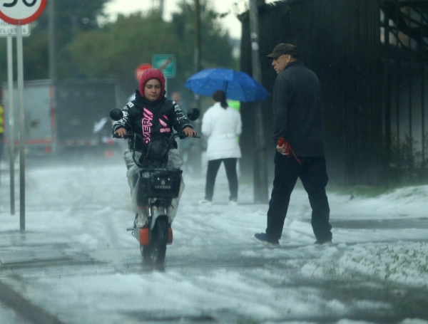
Bogota, a city known for its unpredictable "four seasons in a day" weather, experienced a jarring meteorological transition this past Monday. Residents who began their morning under the warmth of a clear sky and temperatures hovering near 24°C found themselves caught in a violent display of nature by the afternoon. The capital was swept by intense, localized storms accompanied by heavy hail, a combination that paralyzed key transit arteries and tested the city’s drainage infrastructure.

As the city continues to navigate the complexities of the El Niño phenomenon, this event serves as a stark reminder that global climate patterns do not render local, extreme weather events obsolete. Instead, they transform the frequency and intensity of these occurrences.
The Chronology of a Meteorological Pivot
The transition began in the early hours of Monday, October 5, 2026. The atmosphere over the capital was unusually stable and warm, with the thermometer climbing toward a comfortable 24°C, leading many to expect a mild start to the work week. However, meteorological data suggests that the calm was deceptive.

By approximately 2:20 p.m., the Bogotá Alert System (SAB) began detecting the rapid accumulation of moisture. The atmospheric pressure and wind patterns shifted, ushering in a significant moisture front from the surrounding geography. What followed was a rapid buildup of cumulonimbus clouds, which unleashed a torrential downpour and a localized, yet aggressive, hail storm.
The impact was immediate and concentrated in the western and central sectors of the city. Localities such as Engativá, Kennedy, and Suba bore the brunt of the storm, with residents reporting near-zero visibility and streets turned into temporary rivers. Shortly after, reports of similar, though slightly less severe, precipitation began filtering in from Fontibón and Los Mártires. By late afternoon, the city was left to grapple with the aftermath of the storm: downed trees, flooded transit corridors, and damaged residential roofing.

Supporting Data and Meteorological Context
To understand why a morning of 24°C heat resulted in such a violent afternoon, one must look at the thermodynamic interaction between the surface heat and incoming humidity. Guillermo Escobar, Director of the District Institute for Risk Management and Climate Change (Idiger), explained that the high morning temperatures acted as a catalyst.
"When we have sustained heat in the morning, the ground and the lower atmosphere retain significant energy," Escobar noted. "When that moisture front entered the city in the afternoon, it reacted with that thermal energy, triggering rapid cloud development and the subsequent heavy precipitation and hail we witnessed."
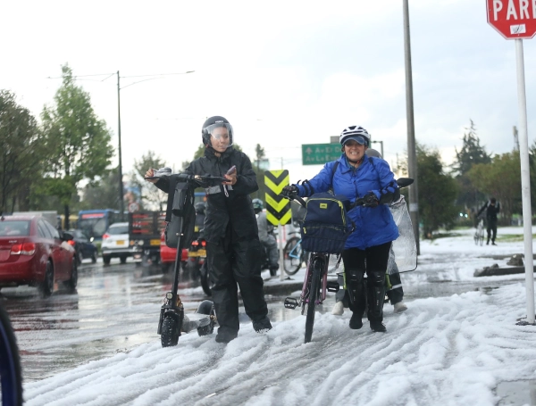
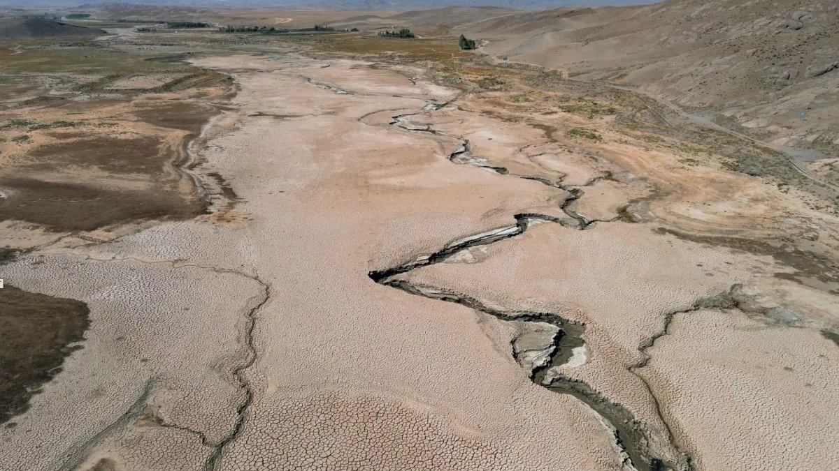
While the current climate discourse in Colombia is dominated by the presence of El Niño, experts warn against the misconception that this phenomenon leads to a complete cessation of rainfall. On the contrary, El Niño alters the distribution of rain. It creates "erratic patterns" where periods of drought are punctuated by intense, high-impact storms when atmospheric conditions align. The hail observed on Monday is a signature of these intense vertical movements within storm clouds, common during the transition months of October and November.
Official Responses and Immediate Impact
The municipal response was mobilized almost immediately. The Idiger deployed specialized teams to the most affected zones—specifically Engativá, Suba, and Kennedy—to manage the physical consequences of the storm.

Managing Infrastructure and Mobility
The primary challenges reported by the District were:
- Arboriculture Issues: The high winds and saturated soil led to the collapse of several trees in the northern and western districts, posing a threat to pedestrians and vehicles.
- Structural Damage: Several residential and commercial buildings reported damage to roofs and awnings due to the weight and velocity of the hail.
- Traffic Paralysis: The drainage systems in areas like the "Deprimido del Portal El Dorado" (a major transit underpass) reached capacity quickly, leading to significant water accumulation that halted traffic and caused massive delays for commuters returning home.
The District, through the District System for Risk Management and Climate Change, continues to monitor these points, emphasizing that these events are not "freak" occurrences, but rather a seasonal reality for Bogotá during this time of year.

The Week Ahead: Is the Storm Over?
The meteorological outlook for the remainder of the week is far from stable. The Institute of Hydrology, Meteorology and Environmental Studies (Ideam) has released a forecast indicating that Bogotá should brace for a week of frequent, though varied, rainfall.
A Day-by-Day Forecast
- Tuesday, October 6: High probability of strong rains across the western region of Cundinamarca, with moderate showers expected in the capital.
- Wednesday, October 7: Forecasted as one of the most intense days for rainfall. Ideam warns of heavy precipitation across the national territory, with Bogotá and its surrounding areas potentially seeing the highest volumes of water accumulation.
- Thursday, October 8: A change in the atmospheric structure is expected due to the passage of Tropical Wave No. 55. While the focus of heavy rain will shift toward northern Colombia (La Guajira, Santander, and Córdoba), Cundinamarca will still experience moderate, persistent showers.
- Friday, October 9: The week concludes with continued instability. Forecasters expect strong rain in western Cundinamarca, with scattered, lighter showers in Bogotá.
The prevailing trend for the week is one of persistent moisture. While the intensity will fluctuate, the consistent influx of humidity across the country ensures that the "rainy season" feel will remain the defining characteristic of the coming days.
Implications for Urban Resilience
The events of Monday highlight a critical challenge for Bogotá: urban resilience in the face of increasingly erratic weather. As the city continues to expand, the intersection of rapid development and changing climate patterns requires a more robust approach to infrastructure.
- Drainage and Maintenance: The flooding at major transit hubs suggests that current drainage systems are being pushed to their limits by the increasing volume of water in shorter, more intense bursts. Proactive cleaning of storm drains and the upgrading of water management infrastructure in flood-prone areas are essential.
- Public Preparedness: The Idiger has urged citizens to take preventative measures. This includes securing loose objects on rooftops, ensuring that rain gutters are clear of debris, and avoiding travel during the peak hours of forecasted storms.
- Long-term Planning: The fact that experts are now linking even minor, localized storms to broader regional climate shifts suggests that urban planning must incorporate "climate-adaptive design." This means building structures that can withstand not just the average weather, but the extremes that are becoming more common.
Conclusion: Living with Uncertainty
As Bogotá continues to experience the meteorological instability inherent to its geography, the events of this past Monday serve as a poignant reminder. We are no longer operating under the assumption of "predictable" seasons. The warming of the atmosphere, coupled with the complex interplay of tropical waves and global phenomena like El Niño, demands a citizenry and a government that are equally adaptable.

For now, the advice from the authorities remains clear: keep an umbrella at hand, stay informed through official channels, and anticipate that in Bogotá, the most beautiful, sunny morning can, in a matter of hours, give way to a storm that tests the very foundations of the city.
As we look toward the remainder of October and November, the message is one of vigilance. The rain is not an anomaly; it is the current rhythm of our capital, and navigating it successfully will require both caution and the continued strengthening of our city’s resilience against the elements.