
By Edwin Caicedo
Environment and Health Journalist
Updated: October 31, 2026
Main Facts: The Race Against Time After a Seismic Event
In the harrowing seconds immediately following a major earthquake in Colombia, a critical question echoes across living rooms, coastal towns, and newsrooms alike: Will this trigger a tsunami?

Time and again, citizens breath a sigh of relief as the National System for Tsunami Detection and Alert (SNDAT, for its Spanish acronym) swiftly rules out the threat. While these rapid dismissals often feel effortless to the public, they are the culmination of a sophisticated, high-stakes operational workflow. Behind every rapid public advisory lies a seamless integration of real-time seismic data, mareographic analysis, and rapid institutional coordination.
Colombia’s unique geographic positioning exposes its extensive coastlines along both the Pacific Ocean and the Caribbean Sea to multifaceted marine hazards. The country is vulnerable to tsunamis originating from local, regional, and distant sources driven by seismic activity, submarine volcanic eruptions, and other geophysical phenomena capable of displacing massive volumes of water.

Consequently, merely confirming that a seismic event has occurred and pinpointing its magnitude is insufficient. Authorities must instantly analyze complex fault dynamics to evaluate tsunamigenic potential. This heavy responsibility is shared among three core national institutions: the Colombian Geological Survey (SGC), the General Maritime Directorate (Dimar), and the National Unit for Disaster Risk Management (UNGRD). Together, they form an unbroken chain of scientific detection, technical assessment, and emergency coordination designed to protect millions of coastal residents.
Chronology: The Lifecycle of a Tsunami Threat Assessment
When the earth shakes in or near Colombia, information flows through a strictly regulated, multi-step pipeline designed to minimize latency and eliminate institutional friction.

1. Seismic Detection and Characterization (The SGC)
The first critical link in the chain belongs to the Colombian Geological Survey (SGC). Operating state-of-the-art seismic monitoring networks across the nation, the SGC is tasked with detecting tectonic tremors the moment they register on instruments. Within minutes—sometimes seconds—the agency isolates three fundamental parameters:
- Epicentral Location: Exactly where the rupture occurred, whether onshore, offshore, or along oceanic trenches.
- Magnitude: The total energy released by the earthquake.
- Hypocentral Depth: How deep the rupture occurred beneath the Earth’s crust, a vital clue since shallow undersea earthquakes are far more likely to displace the seafloor and generate dangerous waves.
Once calculated, this seismic profile is immediately funneled to meteorological and oceanographic experts.

2. Tsunami Potential Analysis (Dimar and the CNAT)
Armed with the SGC’s seismic parameters, the General Maritime Directorate—acting through the National Tsunami Alert Center (CNAT)—takes over the second phase of the protocol.
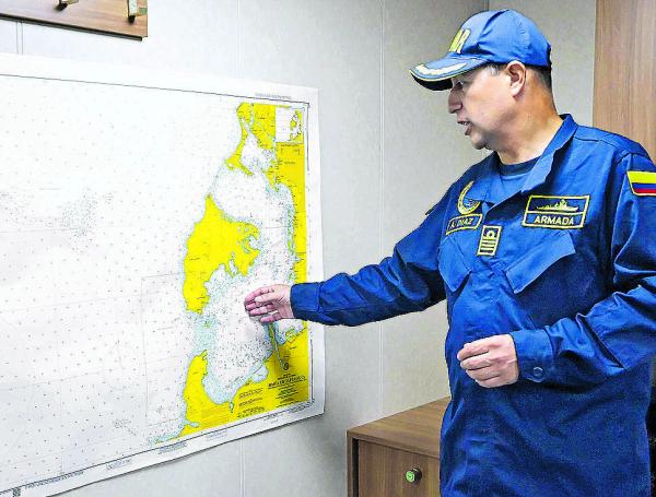
The CNAT cross-references the seismic data with real-time ocean observations gathered from a dense network of coastal mareographs and sea-level gauges. By modeling how the seafloor displacement could alter water columns, oceanographers evaluate the event’s tsunamigenic potential. It is the CNAT that possesses the institutional authority to formally declare the appropriate alert state, translating raw scientific metrics into actionable marine safety tiers.

3. Institutional Mobilization and Public Dissemination (The UNGRD)
Once the hazard level is defined by Dimar-CNAT, the third pillar of the SNDAT—the National Unit for Disaster Risk Management (UNGRD)—activates the emergency response apparatus.
The UNGRD serves as the connective tissue between technical agencies and local governance. It immediately transmits the official evaluation to regional and municipal authorities, triggering pre-planned emergency workflows. This clear division of labor prevents administrative overlap, ensures decisions are grounded strictly in empirical science, and guarantees that both public officials and citizens receive a singular, authoritative voice of guidance.

Supporting Data: The Five Official Alert States
To prevent panic while ensuring appropriate readiness, the National Tsunami Detection and Alert Protocol establishes five standardized states. Declared exclusively by Dimar-CNAT, these tiers dictate mandatory operational responses tailored to the severity of the threat:
- Informative State: Communicates clearly to the public that an earthquake has occurred, but technical evaluations confirm no risk of a tsunami. Life continues as normal.
- Vigilance State: Signifies that while a destructive tsunami is unlikely, minor sea-level fluctuations or unusual currents could occur. Triggers early preparation measures and heightened monitoring.
- Warning State: Indicates a potential threat to coastal zones. Maritime authorities immediately restrict vessel movements, close ports, and place coastal response teams on standby.
- Alert State: The highest level of active threat. It carries an explicit recommendation for immediate coastal evacuation, the activation of municipal shelters, and the mobilization of full-scale emergency response operations.
- End of Monitoring State: Officially signals that the threat has passed, abnormal sea levels have normalized, and the monitoring window for the specific event is closed.
Official Responses and the Reality of "Personal Alerts"
While institutional protocols provide a robust framework for regional and distant tsunamis, authorities openly acknowledge a sobering limitation: time.
For tsunamis of local origin—where the earthquake’s epicenter lies just off the coast—waves can strike nearby shores within minutes. In such scenarios, the time required for scientists to process data, brief officials, and broadcast a formal alert may exceed the time it takes for the waves to arrive.
Recognizing this operational window constraint, the national protocol heavily emphasizes the concept of the ‘Personal Alert’. Under this principle, citizens are instructed never to wait for an official institutional decree if they experience specific natural precursors. The protocol outlines three unmistakable warning signs that mandate immediate self-evacuation:

- A strong, violent earthquake that makes it difficult to stand.
- A sudden, unnatural recession of the sea, exposing the seafloor, reefs, or marine life.
- Unusual, roaring sounds emanating from the ocean or coastline.
By promoting these intuitive triggers, the protocol bridges the gap between high-tech science and grassroots survival, acknowledging that human intuition and swift individual action remain the ultimate lines of defense against rapid-onset marine disasters.
Implications for Coastal Regions and Future Preparedness
The efficiency of Colombia’s tsunami warning apparatus extends far beyond national monitoring rooms; it places heavy legal and operational demands on local governments.
Departmental and Municipal Disaster Risk Management Councils (CDGRD and CMGRD) stationed along the Pacific and Caribbean littorals carry the responsibility of translating national protocols into localized survival plans. Their mandates include:
- Regularly updating municipal emergency response strategies.
- Maintaining clear, well-signposted evacuation routes leading to designated high ground or vertical evacuation structures.
- Conducting periodic community drills to build muscle memory among residents living in high-risk zones.
A Coordinated Shield
Ultimately, Colombia’s defense against tsunamis relies on a delicate, unbroken continuum of cooperation. When the ground shakes, the seamless collaboration between the Colombian Geological Survey, Dimar, the UNGRD, local authorities, and coastal communities transforms raw data into a life-saving shield.

Yet, technology and institutional coordination can only achieve so much. As experts repeatedly stress, the ultimate success of the system rests on an informed public—citizens who understand the science, respect the alert states, and possess the readiness to act on natural warning signs long before an official siren sounds.